")


Climate
Temperatures remain warm throughout the year, with an annual average that ranges between 24 and 26 °C, the maximum occurs during the summer between 26 and 28 °C, while the minimum occurs during the winter between 19 and 22 °C. C as average measure.
The average annual rainfall ranges between 1,200 and 1,400 mm, mainly towards the center and north of the municipality to the south, between 1,000 and 1,200 mm.
The rainiest period is during the months of May to October and the least rainy from November to April where it reaches less than 200 mm.
Winds (trade winds) from the east-northeast predominate during most of the year, during the months of November-March the winds from the south frequently follow each other.
Relief
The municipality in all its extension has a very flat relief; its culminating point is the hill of Peraza with 58 m of altitude. There is an inclination of the north to south plain of approximately 45 m towards sea level. The plain is of the marine type, abrasive-accumulative, with partially muddy flats.
The soils in this territory, towards the north, are hydromorphic of the ferralithic gley and yellowish quartzite gley types, laterized, in the central region red type allomorphites and ferritic type predominate in the south; near the coast, they are hydromorphic swampy, with a high content of organic matter and poor drainage. The PH is between 6.1 and 6.5 in the central-east part and in the south, it is 6.5. Near the coasts, the soils of the municipality are very productive.
Coast
The coast located to the south of the municipality, has a length of approximately 4 km, very little uneven, it extends from a small inlet, called Embarcadero de Baraguá to the end of Santa Ana. This area in all its extension is low and swampy with predominance of mangrove vegetation. There is small cays to the south that belongs to the Jardines de la Reina archipelago, which some years ago stood out for its tourist use (Cayo Muerto).
Hydrography
The aboriginal word «baraguá» means 'water at a stick', and the aborigines were not mistaken, since this territory is one of the richest in hydraulic resources in the province of Ciego de Ávila.
Surface waters are represented by numerous small streams with an intermediate regime, which discharge their waters into the Itabo River, the most important in the municipality, which rises to the north of it. The basin of this river has an area of 571 km² and a length of 46 km, the average width is 7 meters. Groundwater is abundant, mainly towards the northern and central regions, and in the strip near the southern coast, it is scarcer.
Floors
The soils in this territory, towards the north, are hydromorphic of the ferralithic gley and yellowish quartzite gley types, laterized, in the central region red type allomorphites and ferritic type predominate in the south; near the coast, they are hydromorphic swampy, with a high content of organic matter and poor drainage. The PH is between 6.1 and 6.5 in the central-east part and in the south, it is 6.5. Near the coasts, the soils of the municipality are very productive.
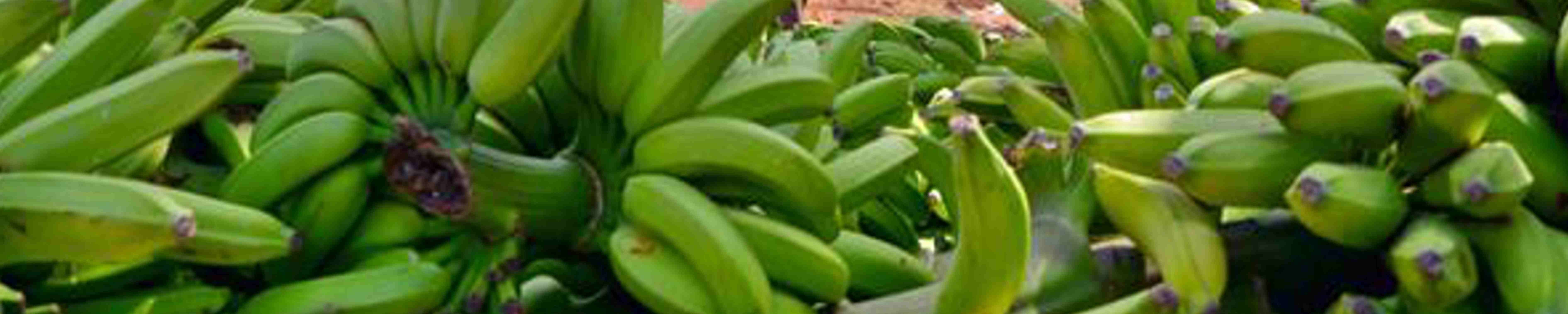
Main crop
The vegetation of the municipality was from south to north typical mangroves near the coast, typical evergreen forests of swamps, mesophilic with fluctuating humidity and typical mesophilic. The current vegetation in the same direction is mangroves, swamps and pastures with foci of crops, natural savannahs, secondary vegetation and agricultural crops with foci of pastures, sugar cane and secondary vegetation.
The vegetation of the municipality was from south to north typical mangroves near the coast, typical evergreen forests of swamps, mesophilic with fluctuating humidity and typical mesophilic.
The current vegetation in the same direction is mangroves, swamps and pastures with foci of crops, natural savannahs, secondary vegetation and agricultural crops with foci of pastures and secondary vegetation.
Fauna
The predominant fauna to the south is mangroves and swamps, the rest of the municipality are anthropogenic communities. As an important endemic species there are specimens located to the south, among them are the jutía conga, snail hawks, freshwater hens, pinar tomeguins, Cuban crows, etc.